


iMotoneige
1.95.00 Reviews
App Specs
- Version
- 1.5.8
- Updated On
- License
- Free
- Downloads
- 10,000+
- Developer
- FCMQ
- Categories
- Travel & Local
- Platform
- Android, iOS
Screenshots
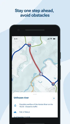
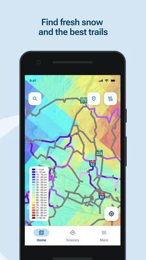

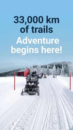
 Analysis by AppCompare
If you're a fan of winter sports and have always dreamed of exploring snowy landscapes on a snowmobile, then iMotoneige might just be the app you've been waiting for. I decided to give it a whirl, and here's what I found.
Exploring the Interface
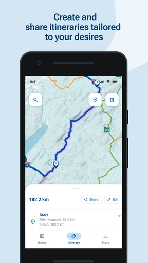
When you first open iMotoneige, you're greeted with a clean and intuitive interface. The design is sleek, making it easy to navigate through the various features. As someone who isn’t particularly tech-savvy, I appreciated how straightforward everything was laid out. The app provides a map that highlights all the nearby snowmobile trails, which is its core function.
You can quickly locate trails based on your location, which is super handy if you're traveling or just looking to explore new areas. The map is interactive, allowing you to zoom in and out, and it’s color-coded, so you can easily identify open trails versus those that are closed or have restricted access.
The first week: useful orientation, with a clear purpose
The appeal is easy to understand if you ride regularly or are preparing for a trip somewhere unfamiliar. Rather than beginning with a broad travel search, you can start with the practical question a snowmobile rider actually has: what trails are around me, and which ones appear usable? That focused map makes the app feel more purposeful than a general navigation tool during the first days of trying it.
I’d treat the map as a planning aid, not as permission to ride. Trail status can change, and a displayed route cannot replace posted signs, local rules, or sound judgment on the ground. Before setting out, I would check the route at home, note likely turn-offs, and confirm current conditions through reliable local sources. That small routine makes a map more useful without asking it to do more than it can.
For someone new to the area, the most useful first test is a short, familiar outing rather than a long route chosen entirely from the screen. It lets you learn how the map behaves, how quickly details load, and whether the trail information matches what you see. If it works well for that modest task, you can decide whether it deserves a place in your regular riding routine.
Features Galore
The app doesn’t just stop at showing trail maps; it's packed with features that enhance your snowmobiling experience. One of the highlights is the real-time updates on trail conditions. This is a game-changer, especially when you're planning a trip and need to know if the trails are safe and accessible.
Worth Reading Before You Choose

EA SPORTS FC Mobile 26 Is a Bigger Football Game, but It Takes Time

Flipboard Shows What News Apps Must Do Beyond the Feed

Switching to Android Auto Means Rethinking Your Driving Routine

Google Calendar Makes a Crowded Week Easier to Manage

Ludo King Makes the Most of the Minutes Between Plans

Baby Panda World Brings Quick Play to Modern Phones, but Its Game Library Feels Busy
Another feature I found useful was the community-driven updates. Users can contribute information about trail conditions, weather updates, and any hazards they encounter. This creates a community feel and ensures that the information is as accurate and current as possible.
- Weather Integration: The app syncs with local weather services to provide current weather conditions and forecasts.
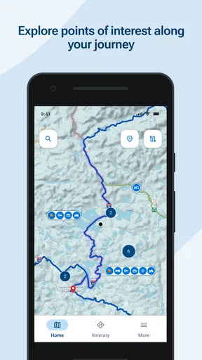
- Points of Interest: Find nearby amenities like gas stations, restaurants, and lodging.
- Safety Alerts: Receive notifications about trail closures, hazardous conditions, and safety tips.
Month-to-month value: a companion, not a reason to ride
Whether this app earns lasting space depends on how often snowmobiling is part of your life. A frequent rider can get recurring value from having trail information and nearby stops in one place, especially when plans involve changing locations. Someone who rides once in a season may find it useful before a single outing but have little reason to open it between trips. That is not necessarily a flaw; it is a specialized tool whose value follows the activity.
A realistic use case is a weekend ride planned with friends. I would use the map to agree on a general area, check the route and nearby fuel or food stops, then share the plan outside the app with anyone who needs it. On the day, I’d keep the map available for orientation and check for updates before committing to a detour. This keeps the app in a supporting role instead of making it the sole source of a group’s decisions.
Its community element may add value over time, but community information is most helpful when it is recent and specific. A rider’s report can flag a concern worth investigating; it should not be treated as a guarantee that the whole trail is safe or open. I would compare a report with official notices and what I can observe locally, particularly after weather changes. That habit is a practical way to benefit from rider contributions without relying on any single post.
For a broader trip, the nearby amenities can help with rough planning, but I would still verify opening times and availability independently before building a schedule around a stop. A map can make a place easy to spot without proving it will meet a group’s needs that day. This distinction matters most on a long ride, where a small assumption about fuel or food can affect the whole plan.
Maintenance burden: keep the map ready before you leave
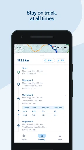
Using iMotoneige is like having a knowledgeable guide in your pocket. The app runs smoothly, and the loading times are minimal, which is crucial when you’re out in the cold and need quick information. I found the GPS tracking feature particularly helpful. It allows you to track your journey and see your progress, which is not only fun but also ensures you don’t lose your way.
One thing I noticed is that the app does require a bit of data usage, especially when loading maps and updates. It might be a good idea to download trail maps in advance if you're heading into areas with spotty cell service.
That preparation is the most useful maintenance habit I can recommend: open the relevant map while you have a dependable connection, inspect the area you plan to ride, and avoid assuming the app will be equally responsive in a remote stretch. GPS positioning and mobile data are different things; seeing your location does not mean fresh map information will load. I would also start with a charged phone and a backup navigation plan rather than letting a single device become the entire safety strategy.
On a cold day, battery life deserves attention too. I’d keep the screen use purposeful, secure the phone where it is easy to check without riding distracted, and stop before interacting with it. These are sensible habits for any phone-based navigation, but they matter especially when gloves, cold conditions, and moving terrain make casual screen use awkward. The app’s convenience is strongest when the route has been considered before the ride, not when a rider is trying to solve every question while moving.
Sources of fatigue: trust, signal, and the social layer
Connecting with other snowmobiling enthusiasts is another perk. The app has a social feature where you can share your experiences, photos, and even plan group rides. It’s like having a mini social network dedicated to snowmobiling, which adds a fun and social dimension to the app.
That social layer will appeal most to riders who already enjoy exchanging local knowledge. It may feel unnecessary if you prefer to plan privately, or if your riding group coordinates through a messaging service they already use. I would not switch a whole group’s established routine just for the novelty of a dedicated space; the useful question is whether sharing trail-specific information there makes coordination clearer and more dependable for your particular group.
There is also a practical trade-off between convenience and attention. Notifications about hazards or closures can be valuable when they are relevant, but no notification system should replace checking conditions before departure. A rider who enables every alert and checks every community post may end up distracted by updates that do not affect the route. I’d keep the app’s role narrow: review information before a ride, make decisions at a stop, and keep attention on the trail while moving.
Compared with general map apps, this tool is more directly shaped around snowmobile trails and rider needs. General navigation can be better for ordinary road directions, broad travel planning, or places where trail-specific information is not the main concern. A dedicated trail app has the advantage of focus, but it should not be expected to cover every part of a trip as well as a road map, local authority notice, or direct check with a destination. I see them as complements rather than replacements.
The rating of 1.9 from 158 ratings is a reason to approach it with realistic expectations and test it on a low-stakes outing before depending on it for an important ride. That number does not tell me which individual issues matter to every rider, but it does make a cautious first run sensible. FCMQ is the developer, and the app has 10K+ installs; neither fact changes the basic advice to verify conditions and learn the interface before heading somewhere remote.
Who should keep it, and who should look elsewhere
I’d recommend trying it if snowmobiling is a regular hobby, if you travel between riding areas, or if finding trail access and nearby stops is a recurring part of your planning. Its focus is more useful in those situations than a generic travel app that treats a snowmobile trail as just another line on a map. Riders who value shared local observations may also appreciate having a community angle alongside route planning.
I would skip it if you want an all-purpose travel planner, need dependable turn-by-turn directions for every kind of transport, or rarely ride and do not need trail information between occasional outings. It is also not the right tool to rely on alone when you lack a connection, have not checked route conditions, or need certainty about access. In those cases, official local information, an established navigation method, or direct confirmation from a relevant source is the safer choice.
The app is free to install, with in-app purchases listed at $3.99 per item. I’d begin with the free experience and decide whether any paid item has a clear, repeated use for my riding routine before spending money. That is especially sensible for occasional riders: a feature that sounds appealing in the abstract is not automatically worth paying for if it will only be used once. The app is rated for Everyone, and the current version is 1.5.8, with Android 11 as the minimum OS requirement.
Long-term verdict
Overall, iMotoneige is a comprehensive tool for anyone who loves snowmobiling. It combines functionality with a user-friendly interface, making it an invaluable resource for both seasoned riders and newcomers to the sport. Whether you're planning your next adventure or just curious about the snowmobiling scene, this app has got you covered.
My longer-term view is a little more measured: its lasting value comes from repeated, practical use, not from installing it and expecting it to make every ride effortless. If trail maps, status checks, and local context solve a problem you face on most outings, keeping it ready makes sense. If you only need those things for one trip, it may be a seasonal tool rather than a permanent fixture on your home screen. The app’s release date is Nov 15, 2024, and its recent redesign is a useful reason to reassess the experience, but a fresh look alone does not create a habit.
So, if you're ready to hit the trails and explore the winter wonderland, give iMotoneige a try. It might just become your go-to app for all things snowmobiling!
I’d make that recommendation with one condition: use it as a focused planning and reference tool, then keep your decisions grounded in current local conditions and safe riding practice. For the right rider, that is enough to justify keeping it installed through the season. For everyone else, there is no need to force a specialized app into a routine it does not genuinely improve.
Pros
- User-friendly interface for all ages.
- Real-time trail updates enhance safety.
- Offline maps available for remote areas.
- Customizable weather alerts.
- Supports multiple languages for accessibility.
Cons
- Limited features in free version.
- Occasional GPS inaccuracies reported.
- Heavy battery usage on long trips.
- Requires internet for most features.
- Advertisements can be intrusive.
FAQs for iMotoneige
What is iMotoneige and how does it work?
iMotoneige is a mobile application designed for snowmobile enthusiasts. It offers detailed trail maps, weather updates, and safety alerts. By using your device’s GPS, it provides real-time navigation and tracking, ensuring a smooth and safe snowmobiling experience. Users can also access maintenance tips and community forums.
Is iMotoneige available for both Android and iOS devices?
Yes, iMotoneige is available for download on both Android and iOS platforms. You can find it on the Google Play Store and the Apple App Store. The app is designed to run smoothly on most smartphones and tablets, providing a seamless experience across devices.
Are there any subscription fees or in-app purchases in iMotoneige?
iMotoneige offers a free version with basic features, but for enhanced functionality, users can opt for a premium subscription. This includes advanced trail maps, offline access, and ad-free usage. In-app purchases are available for additional features like custom trail guides and exclusive community events.
How accurate are the trail maps and weather updates in iMotoneige?
iMotoneige provides highly accurate trail maps and weather updates, leveraging the latest GPS technology and meteorological data. The app is frequently updated to ensure that users receive the most current information, enhancing safety and planning efficiency for snowmobile trips.
What safety features does iMotoneige offer for snowmobilers?
iMotoneige includes several safety features such as real-time location sharing, emergency contact notifications, and alerts for trail hazards. The app also offers tips on safe snowmobiling practices and a section for reporting incidents, making it an essential tool for any snowmobiler concerned with safety.


